Datums represent the shape of the earth and because they are different, there can be "shifts" between data in one datum and data in another datum. The shift is just a few meters between some datums, such as NAD 83 and WGS 84. However, the datum shift can be over 100 meters for other datums.
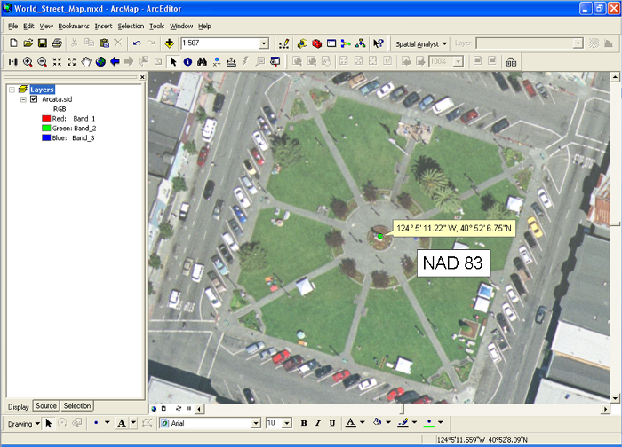
Below is an image in ArcGIS of the coordinate, 40° 52' 6.75" N, 124° 5' 11.22" W. This coordiante is in the middle of the plaze in downtown Arcata, California.
Now, look at the same coordinates using the NAD27 datum:
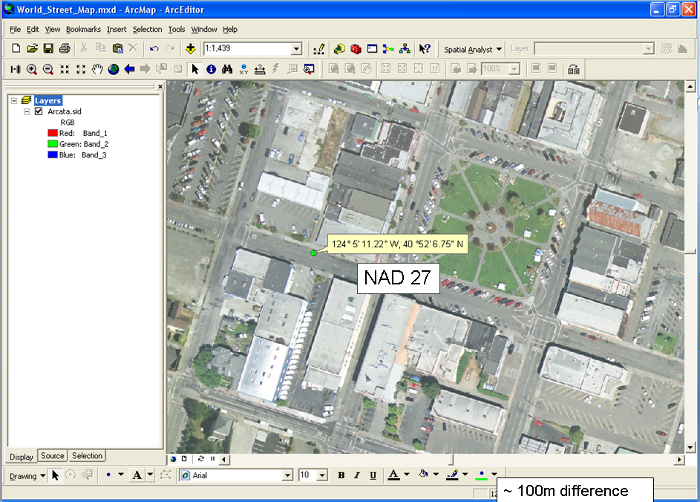
This represents about a 100 meter difference in the location of the coordinate! This is why it is critical to use the correct datum for your data and to make sure all your data is in the same datum or you use a "Geometric Transformation" to correct for the shift.
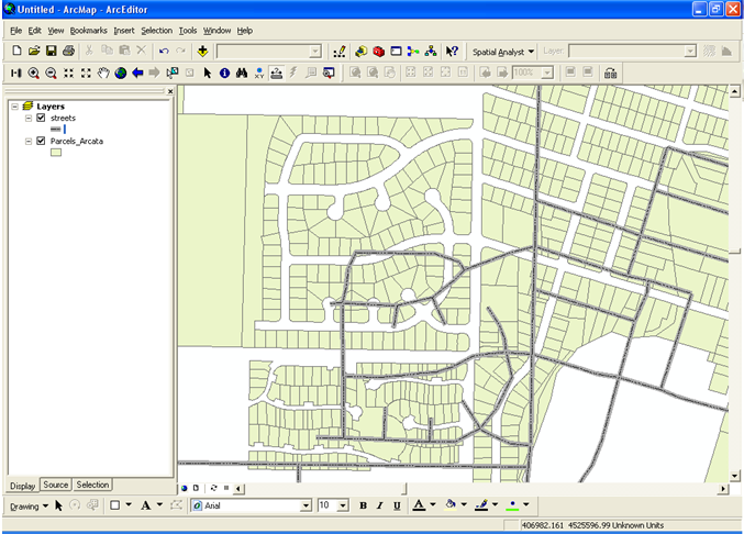
Below is another example of two datasets that are shifted because of mistakes with datums.
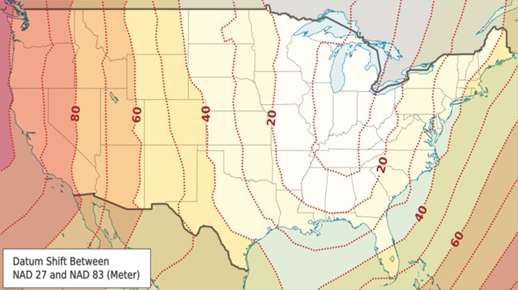
This image shows the amount of shift between the NAD 27 and NAD 83 datums throughout the continental US. Notice that the western edge of the US is one of the worst locations for shift between these datums.
© Copyright 2018 HSU - All rights reserved.